
Piece description from the artist
Are you looking for abstract wall art that also has personal meaning? That's exactly what I was searching for when I started working with maps as imagery. I didn't want it to be cutesy- no hearts or cartoon creatures. I just wanted a bold, colorful, vibrant piece of art that showed off my neighborhood. It didn't exist, so I made my own – and Carland Cartography was born.
My background is in the visual arts. I have both a BFA and MFA and have a deep desire to create and work with my hands. I have always been interested in maps and think they are a great way to visually represent stories. I started drawing maps of Boston neighborhoods in 2012 while I was finishing a graduate certificate in Urban Planning. It was a great way to combine my love of making with my interest in the built environment.
Since then, I have created abstract map drawings of over 100 locations, ranging from the Northeast to the Southwest. My work has grown with me as life has changed, but one thing remains true- I love drawing maps and want to be able to make something for my customers that makes them happy. I'm excited to make work that is a way for people to show off their favorite city, neighborhood, or place on the globe.
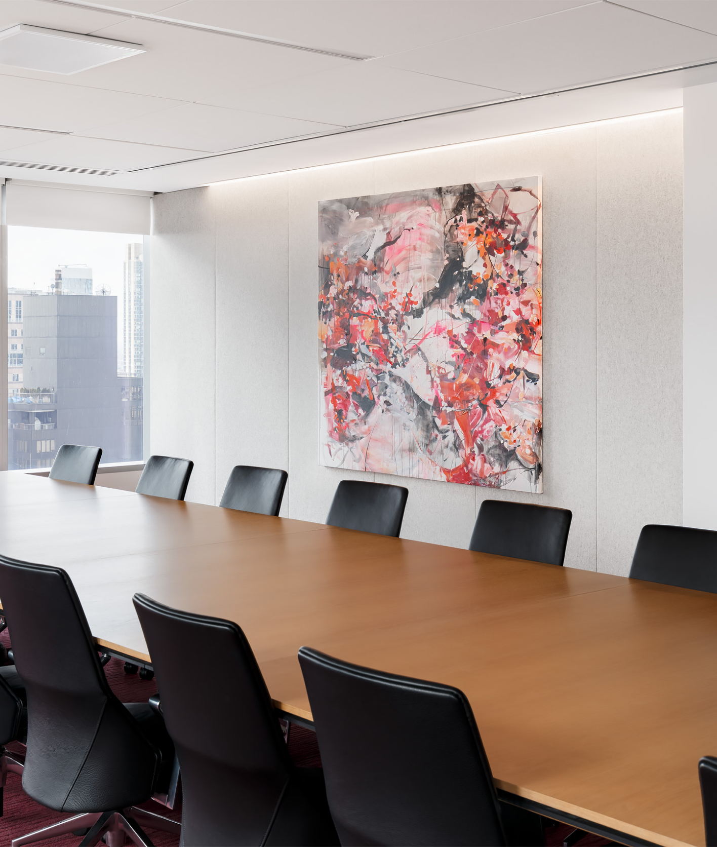
The piece you are seeing here is included as part of my "Boston Neighborhood Series". It shows the East Boston neighborhood, with Logan Airport at the bottom right and the Boston Harbor on the left. At the very bottom left is Boston's North End, and part of Charlestown directly above it. At the top center is part of Chelsea.
This piece is done in colors that are representative of the last few cool days as we transition from Winter into Spring. The golden yellow and warm oranges found in the budding flowers mix with the grays and blues found in the cloudy, rainy skies. Hang this piece in your space and be reminded that we are always changing, growing, and shifting into something new.
To learn more about my artwork visit www.carlandcartography.com


Jennifer Carland is an artist who works with mixed media to create abstracted versions of aerial views and city maps. The work that she creates is loosely based on real geography and is abstracted so that the shapes, line, and color of the maps are altered to create a unique piece of artwork, showing an artistic representation of a real place.
Jennifer works with a variety of artistic materials and is fascinated by aerial views of the world around her. Each finished piece that she creates is of a map carefully selected for its geographical attributes and visual appeal then altered to create a unique piece of artwork. The finished product is a combination of hand-drawn and digitally altered images with many layers of colors and textures. The focus of her work is on interpreting the lines and shapes of a city map and changing the purpose of a map from utilitarian to conceptual. She intends to make the viewer think about their own place in relation to what is around them and appreciate the beauty in both the built and natural environments.
An Art Advisor will get in touch with you today to schedule a free consultation to discuss your artwork needs.
Get Started By
By